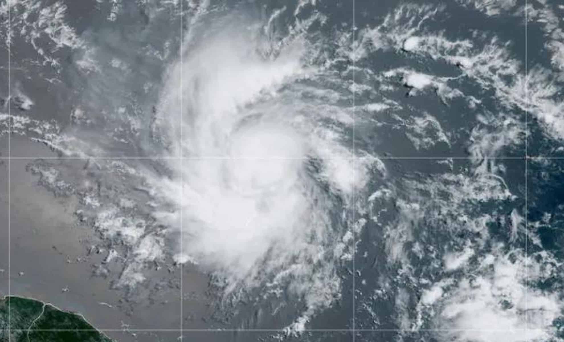
Tropical Storm Beryl has formed in the Atlantic and is forecasted to strengthen into the first hurricane of the 2024 season.
The storm, currently packing maximum sustained winds of 60 mph, is moving west at 21 mph toward the Windward Islands. This development comes amid predictions of an above-normal hurricane season, raising concerns for the regions in its projected path.
Tropical Storm Beryl: Formation and Current Status
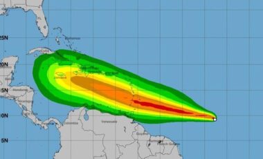
Tropical Storm Beryl was identified on Friday night, approximately 975 miles east-southeast of Barbados. As of early Saturday, Beryl was moving toward the southeast Caribbean and is expected to strengthen into a hurricane by the time it reaches the Windward Islands, including Barbados, Martinique, Grenada, and Dominica.

The storm's current maximum sustained winds are 50 mph, but forecasters predict that Beryl could become a major hurricane with winds exceeding 111 mph, reaching Category 3 status early next week.
According to the National Oceanic and Atmospheric Administration’s (NOAA) National Hurricane Center, the storm is expected to bring heavy rain, strong winds, and dangerous storm surges to the affected areas.
Impacts and Preparedness
Barbados has already issued a hurricane watch, anticipating flash flooding and power outages. Barbadian Prime Minister Mia Mottley emphasized the importance of preparation, stating, "We need to be ready. You and I know when these things happen, it is better to plan for the worst and pray for the best." The island nation is currently hosting thousands of visitors for the Twenty20 World Cup cricket final, adding to the urgency of the preparations.
Beryl is predicted to drop up to 6 inches of rain in Barbados and nearby islands. The storm is also expected to bring high surf warnings with waves up to 13 feet. Here are the potentially affected areas: current models show Beryl could impact regions in the Gulf of Mexico, with particular attention on states like Texas, Louisiana, Mississippi, Alabama, and Florida.
Unusual Early-season Development
The formation of Tropical Storm Beryl in this part of the Atlantic is unusual for this time of year. Only seven named tropical storms have formed in this area (south of 20 degrees north and east of 60 degrees west) before July 4 in nearly 175 years.
This early formation is influenced by below-normal wind shear, which reduces the disruptive winds that typically inhibit storm development in the early summer months. Michael Lowry, a Florida-based hurricane expert, noted, "The development of a tropical storm this far east in the tropical Atlantic is uncommon, though not unprecedented."
Broader Context and Season Predictions
Beryl's formation comes during what is predicted to be a busy hurricane season. Last week, Tropical Storm Alberto brought torrential flooding to portions of southern Texas and northeastern Mexico, resulting in at least four deaths in Mexico.
Forecasters, including NOAA, have predicted an "above average" hurricane season with 17 to 25 storms, 8 to 13 hurricanes, and 4 to 7 major hurricanes of Category 3 or higher. This forecast is driven by low wind shear and above-average sea surface temperatures, conditions that are conducive to the formation and strengthening of tropical storms and hurricanes.
Preparation and Response
As Beryl approaches, residents in the potentially affected areas are urged to prepare. Mark Spence, a manager of a hostel in Barbados, expressed a calm readiness: "It's the season. You can get a storm any time. I'm always prepared. I always have enough food in my house." This sentiment reflects the importance of readiness in regions frequently impacted by tropical storms and hurricanes.
The NOAA and other meteorological organizations continue to monitor Beryl closely, providing updates and warnings as the storm progresses. With the hurricane season stretching from June 1 to November 30, continuous vigilance and preparedness are essential for minimizing the impacts of these powerful natural events.


